Date: [April 23, 2024.] The most significant release of UgCS, the best and most powerful flight planning tool for drone pilots, has landed! SPH Engineering is proud to announce the release of UgCS 5.0, marking a major milestone in drone flight planning software evolution. The biggest UgCS update in years is bringing along a refreshed […]
Virtual Surveyor Adds Planimetric Survey Functionality to Latest Release of Smart Drone Surveying Software
Faster Overall Workflow
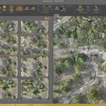
Virtual Surveyor Unveils Photogrammetry App in Major New Release of Smart Drone Survey Software
Seamless Drone Surveying Workflow
American Dronemaker Skydio Asserts Docked Drone Leadership
Bringing the crucial ingredient of trustworthy autonomy to the drone-in-a-box market
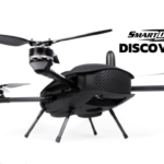
SmartDrone Unveils its Latest Mapping Drone: Discovery 2
Join the live AMA to hear how the new drone is augmenting traditional earth measuring.
TOPODRONE advances airborne bathymetric surveying with AQUAMAPPER launch at INTERGEO 2022
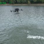
October 18, 2022 – Montreux, Switzerland – TOPODRONE, a Swiss based designer and manufacturer of high-precision LiDAR equipment for installation on drones, vehicles and backpacks, launches AQUAMAPPER, a UAV-based solution for bathymetric surveying and marine construction. The new multitasking data collecting device and TOPODRONE LiDAR ULTRA equipment have been successfully used together for airborne surveying […]
Dedrone Launches DedronePortable for Military and Commercial Entities Around the World
Already purchased for the Ukrainian military, DedronePortable offers easy-to-use, mobile and agile drone response with optional mitigation, and setup in less than 20 minutes
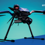
Powerful new autonomy and mapping solution to be unveiled at the Commercial UAV Expo
The Commercial UAV Expo is the place to learn about the most exciting new technologies in UAVs. Returning this year, it hosts an exciting and powerful new solution with the official unveiling of Emesent’s latest integration – Hovermap-Zoe.
Parrot, Verizon, and Skyward bring first 4G LTE connected drone to the US market
New York, United States – Paris, France – August 4th, 2021: Today, Verizon, Parrot, and Skyward announced an exclusive partnership to bring the first out-of-the-box 4G LTE connected drone solution to the United States.
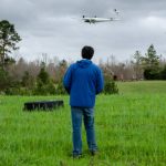
NOAA scientists use drones to see tornado damage in remote areas
After deadly tornadoes struck the Southeast in March, NOAA researchers for the first time successfully captured aerial photos and video of storm damage from hard-to-reach locations using remote-controlled, uncrewed aircraft.

