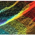
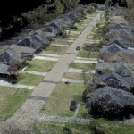
DENVER (Aug. 13, 2015) — The U.S. Geological Survey (USGS) has contracted with Woolpert to evaluate new lidar (light detection and ranging) technologies to assess the suitability to support the 3D Elevation Program (3DEP).
UC Notes – GeoExpress 9.5 Now Supports Native Compression of LiDAR
Lizardtech has continued with their tradition of annual software releases with the announced release of GeoExpress 9.5. The product was announced at esriuc and justifiably so, particularly given the attention that has been paid to LiDAR and the use of imagery at this year’s UC.
LizardTech Introduces GeoExpress 9.5 in Upcoming Webinar
Company to showcase new features of GeoExpress 9.5
Webinar – Introduction to GeoExpress 9.5 now with Support for LiDAR Compression
Find out how you can benefit from the new features of GeoExpress 9.5. The latest version of GeoExpress includes support for LiDAR compression, batch color balancing, multipolygon cropping and more.
ESRIUC Notes – LiDAR is Hot Again at UC
The 2015 esriuc, much like the previous year or two, proved to me that users are very interested in LiDAR.
Feature – LiDAR Data Processing And Asset Management
LiDAR (Light Detection And Ranging): A form of representation of 3D surfaces, Point cloud data, are usually produced by aerial or terrestrial laser scanning, also known as Light Detection and Ranging (LiDAR).
LiDAR Feature – Balloons, the Poor Man’s UAV
With all the recent (and constant) flood of news about high-tech UAVs, it might be nice to take a break and talk about something a little less sophisticated that could also have a significant impact on aerial survey.
LizardTech Launches GeoExpress 9.5 at 2015 Esri International User Conference
Software now includes LiDAR Compression
Dielmo 3D Introduces the Launching of Web Portal OHIO!
Valencia, Spain, Centennial CO, – DIELMO 3D S.L., (www.dielmousa.com) Dielmo 3D is pleased to announce the launching of the Web Portal of OHIO, a 100% CUSTOMIZABLE LiDAR/GIS WEB-PORTAL for the State of Ohio. The demonstrative online GIS web-portal for Ohio is derived from publicly available LiDAR and GIS datasets, providing easy access to the data, […]
Northern Alaska Coastal Erosion Threatens Habitat and Infrastructure
ANCHORAGE, Alaska — In a new study published today, scientists from the U.S. Geological Survey found that the remote northern Alaska coast has some of the highest shoreline erosion rates in the world. Analyzing over half a century of shoreline change data, scientists found the pattern is extremely variable with most of the coast retreating […]


